
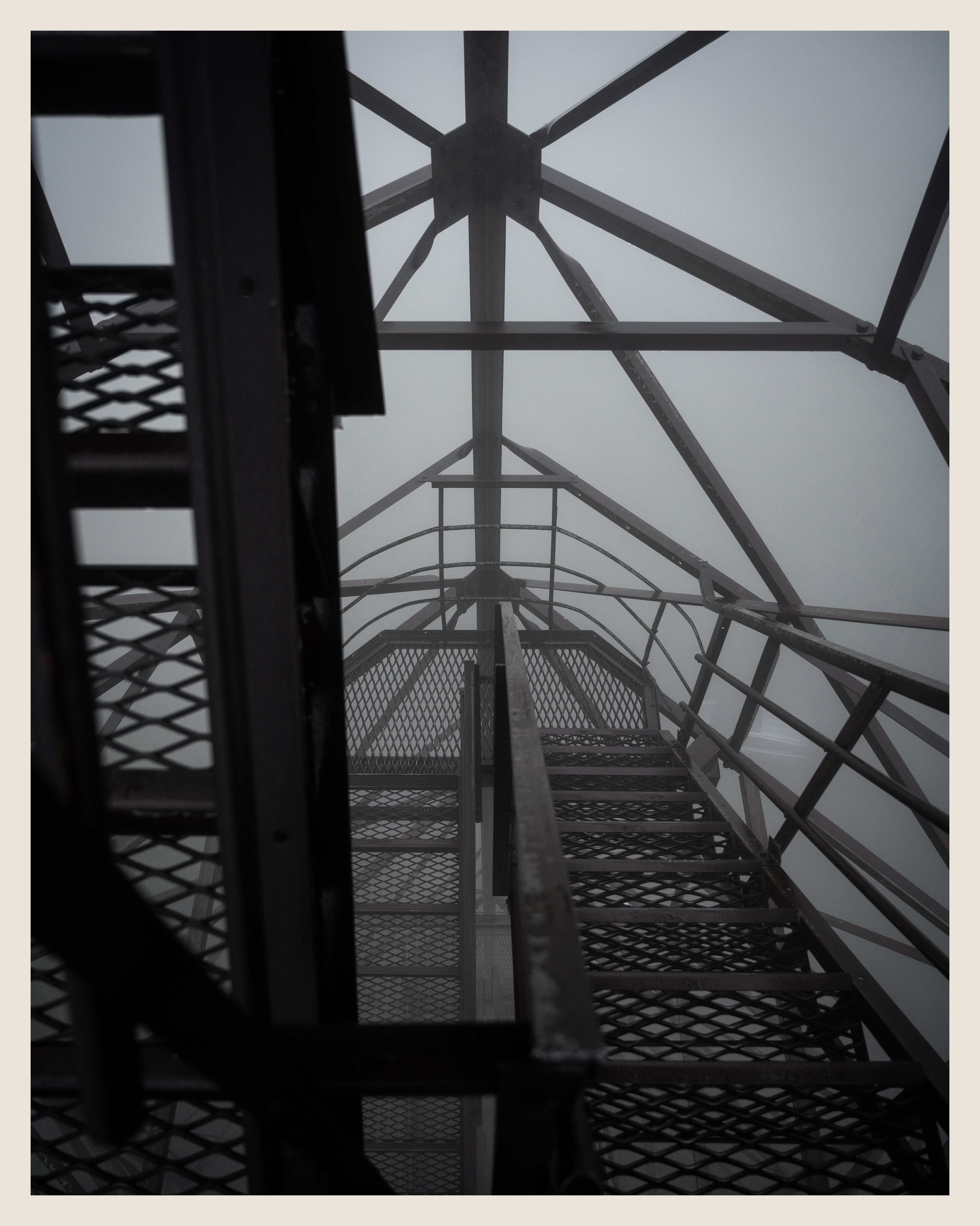
First stop on the 2 day West Virginia trip was Olson Tower, which was constructed to replace the site's previous fire tower in 1963. Normally, visitors are treated to a panoramic view of the surrounding Tucker County, but we were treated to a dense layer of fog at sunrise. This felt like a letdown at first, but in hindsight the fog probably made it a more memorable experience. It felt like we were climbing a stairway into nothingness, with almost no frame of reference for our surroundings or height off the ground. If you look closely at the photo on the right, my car is barely visible about 100ft below.

To my surprise, the cabin door at the top of the tower was propped open. The dense uniform fog made it look as if there were frosted windows in place, so it was a disorienting feeling to stick my arm through the actually-empty window frames.
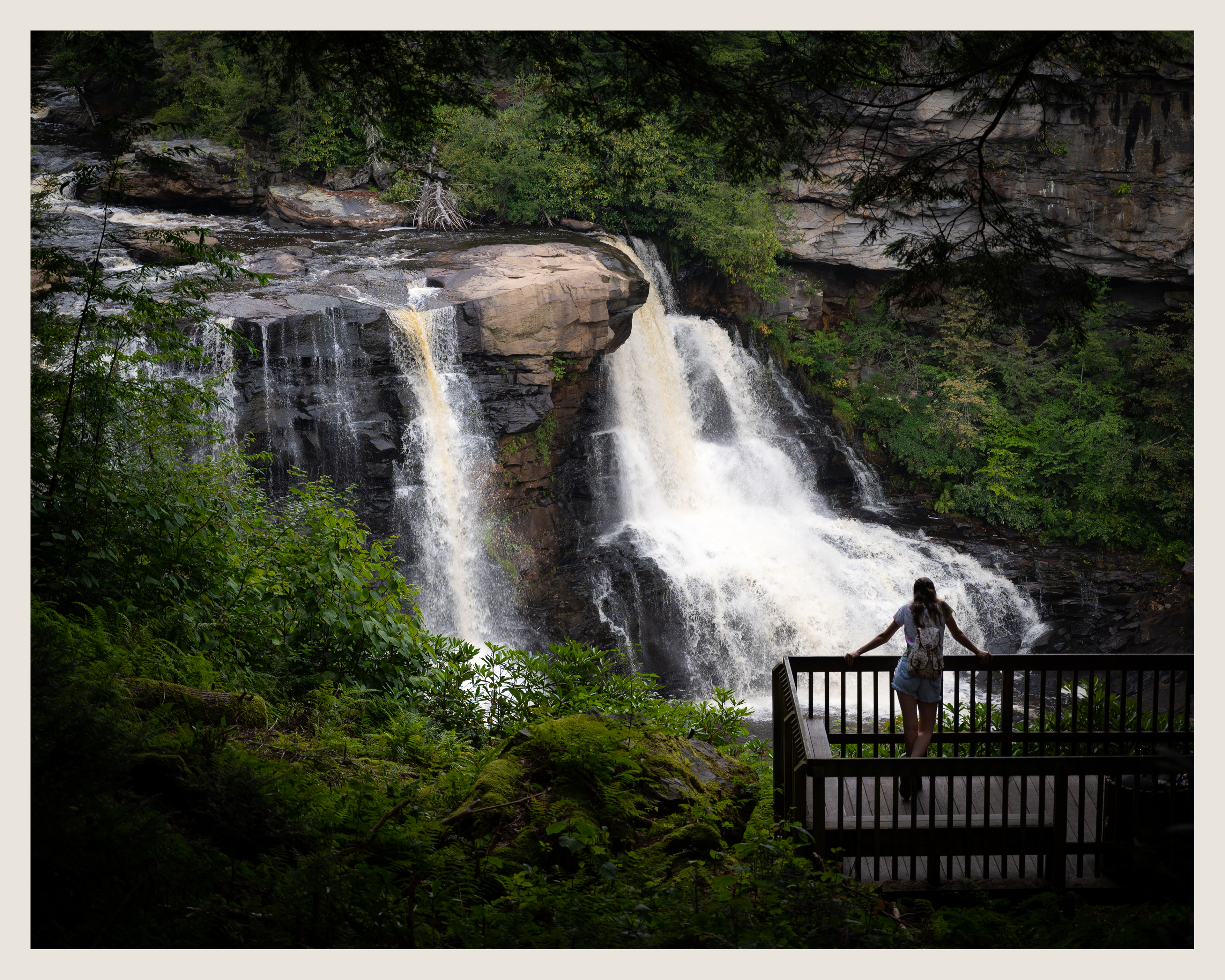
The winding boardwalk at Blackwater Falls made for an easy hike down, and a few straightforward viewpoints. Although they were probably most impressively viewed from the closest platform, I liked the way the foreground foliage framed and created a natural vignette for the falls from this angle.
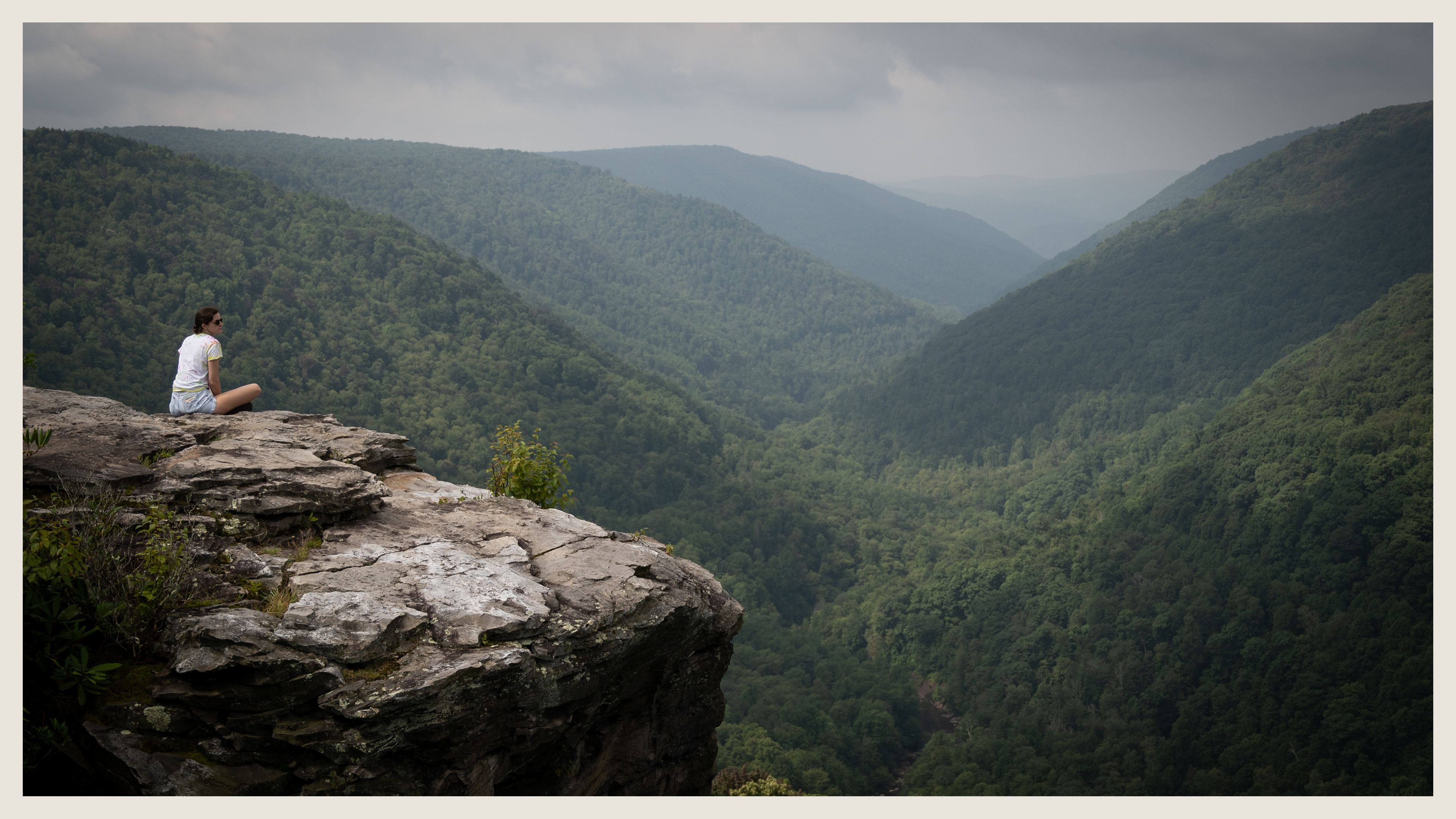
The hike to Lindy Point was relatively short and uneventful, so much so that the grand view of Blackwater Canyon almost felt undeserved. The partly cloudy sky projected a nice patchy texture of light onto the layer of trees in the canyon, and the rush of water could be heard from about 1,000 feet below, despite the presence of a few others at the observation area. I wanted to include some of the chimney rocks in the foreground of my photos, but decided to shoot this one from off to the side, for something other than the balancing rock everyone captures in their photos (for good reason, though).
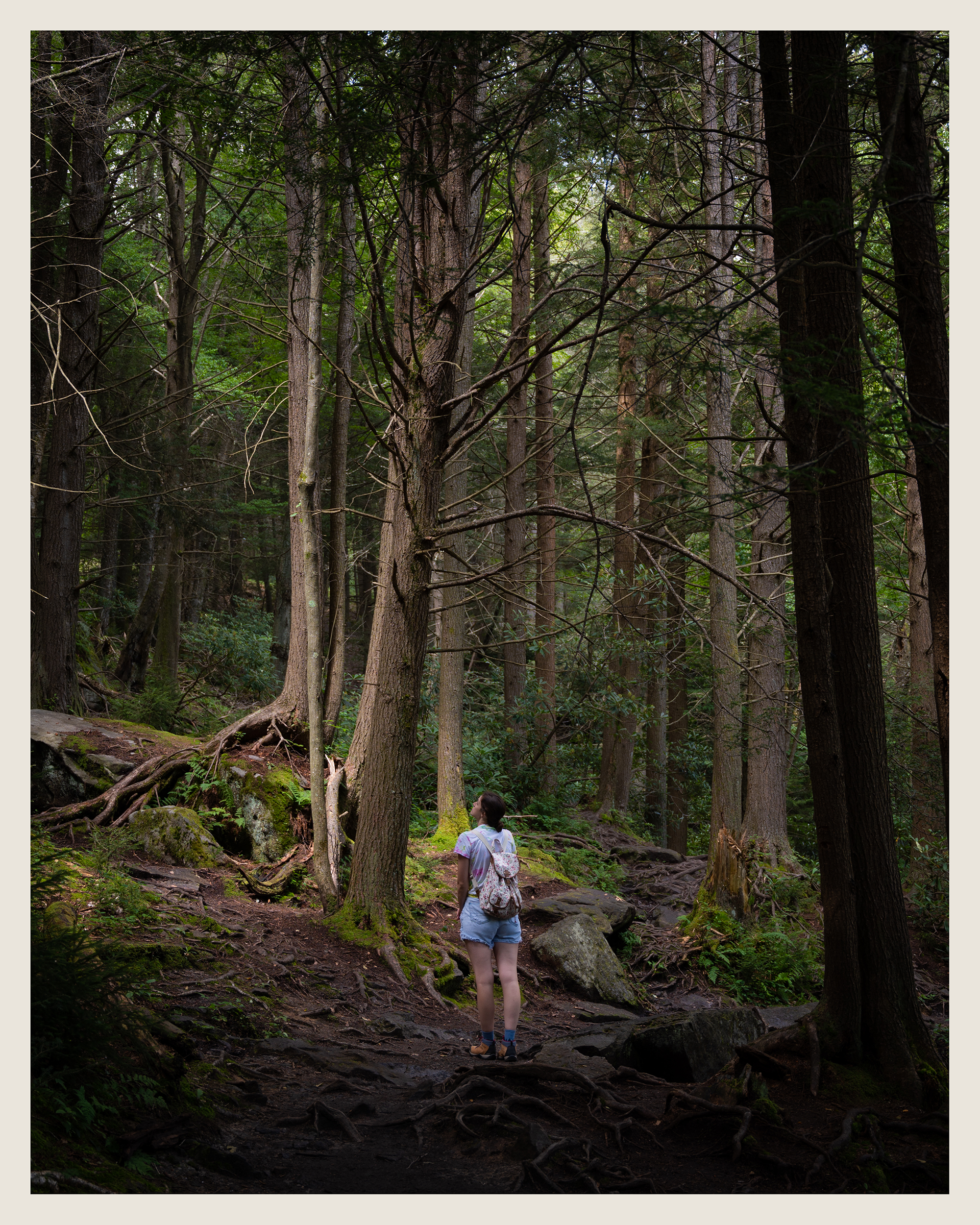
Elakala Trail felt like an enchanted forest, even before reaching the falls. The ground was littered with ferns, huge moss covered boulders, and intricate tree root systems, illuminated by the soft light that broke its way through the treetops. I think Brigid provides a nice sense of scale that isn't there in the empty version of this shot.
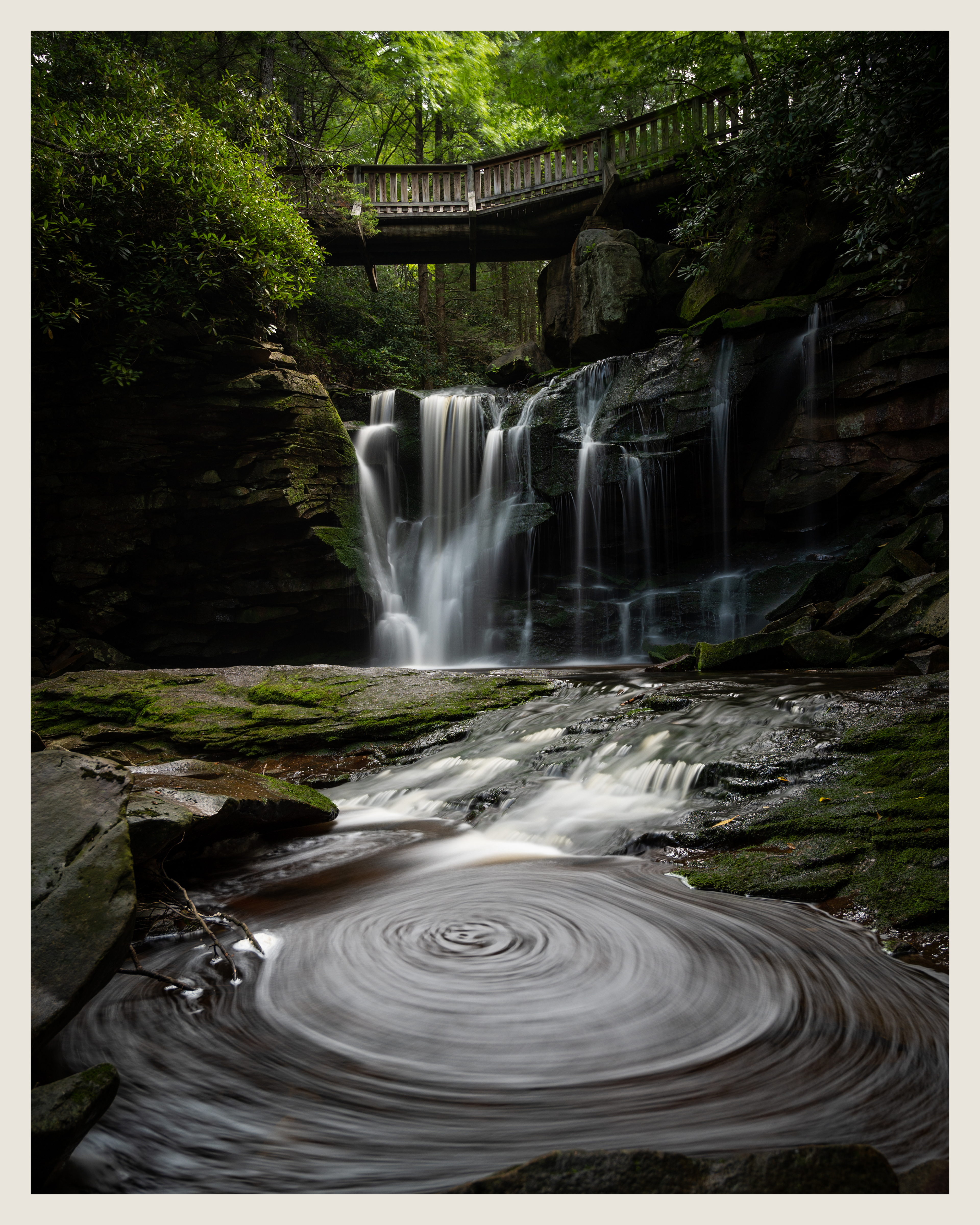
Elakala Falls, although more understated than Blackwater Falls, was just as visually captivating. A scramble down the side of the hill allowed us to view up close along the creek. Sitting near it had a much more calming and peaceful quality, as opposed to the intense power of Blackwater. I know the spinning pool is commonly featured in photos of these falls, but I couldn't help but include it in my frame as well.
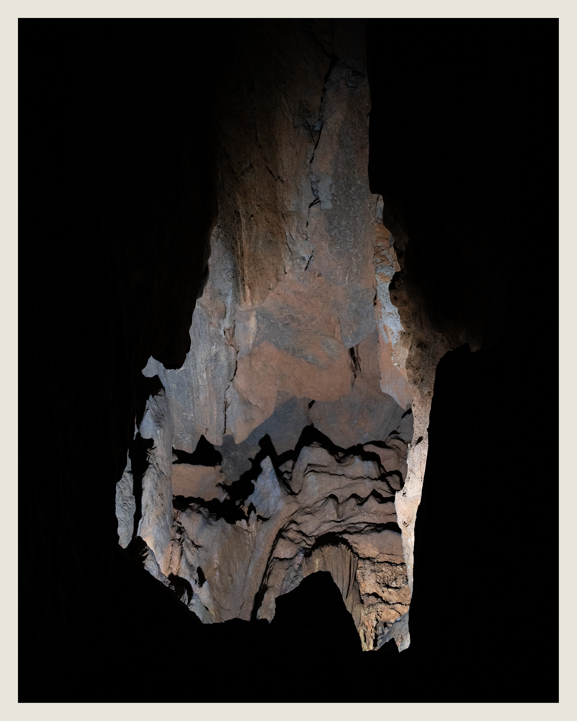

Smoke Hole Caverns was admittedly a bit of a disappointment, being a very small cave with a dead end as the halfway point, and a tour script that felt more focused on delivering uninspired one liners than historical information. Nonetheless, the cave had a few fascinating formations, such as the underground pool, world's largest ribbon stalactite, and the 'Room of a Million Stalactites' with its lofty 274 foot ceiling. The harsh spotlights made shooting handheld photos somewhat difficult, but a few turned out decently. I forget if there was anything particularly significant about the flowstone on the right, but the shot appears to be taken from the back room looking towards the front.
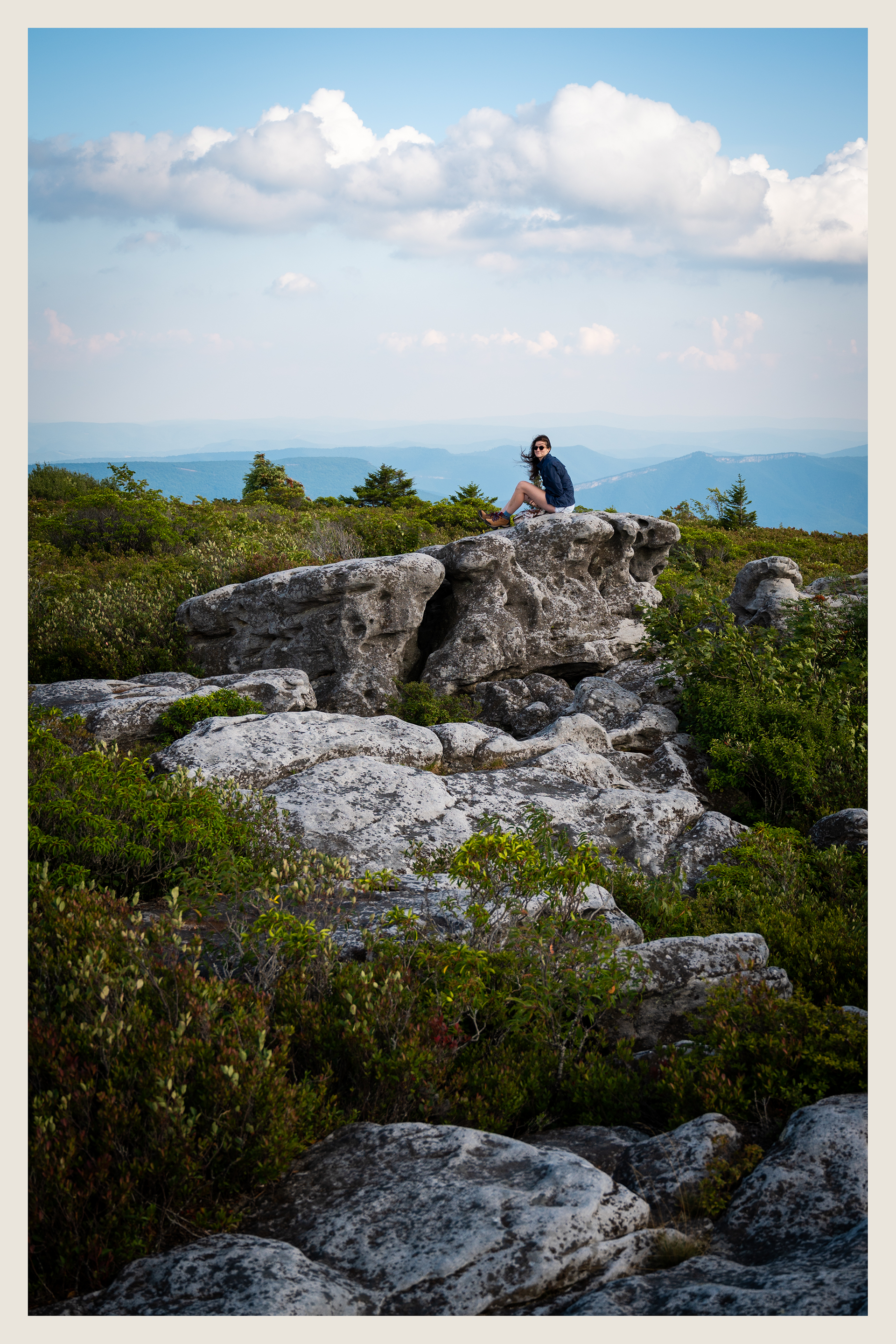

A white knuckle drive up Forest Road 75 led us to Bear Rocks Preserve in Dolly Sods. Despite humanity's best efforts to decimate this area (deforesting, grazing, burning, and using it as a artillery range), there's beauty to be found in every direction. Getting there ended up being a lot of effort for what was ultimately a short visit, but that was sort of the nature of this trip. I'd gladly return to spend a more full day exploring the area, though.
Along with the huge carved boulders, another feature of Dolly Sods I found fascinating was the stunted red spruce trees, with branches bent around backwards from the constant punishing winds. We'd see them a couple more times during the trip, but they were most prominent here.
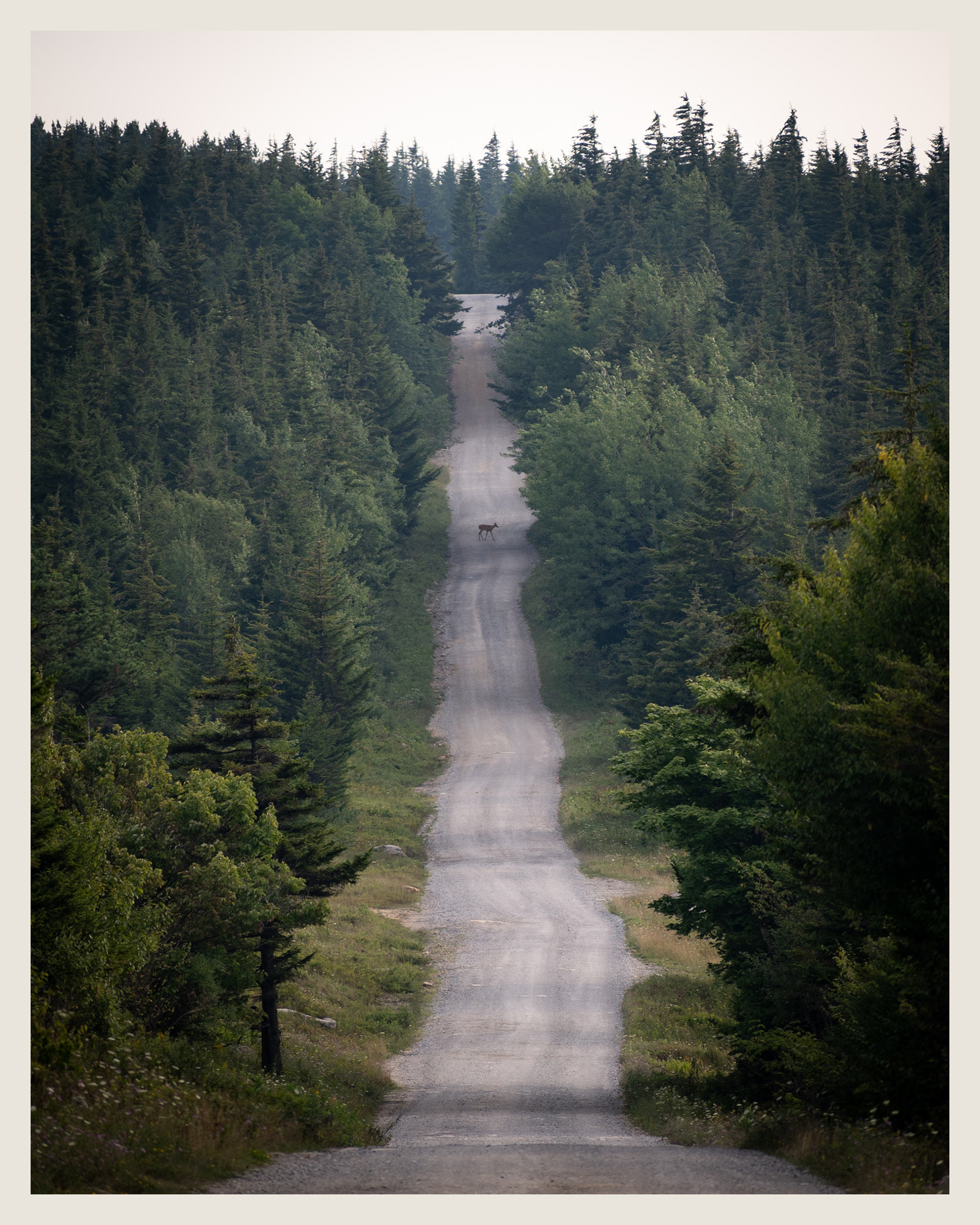
I liked this view of the straight tree-lined road while driving through Dolly Sods. The deer walking across the center of the frame was unintentional but lucky, and brings some life to the shot.
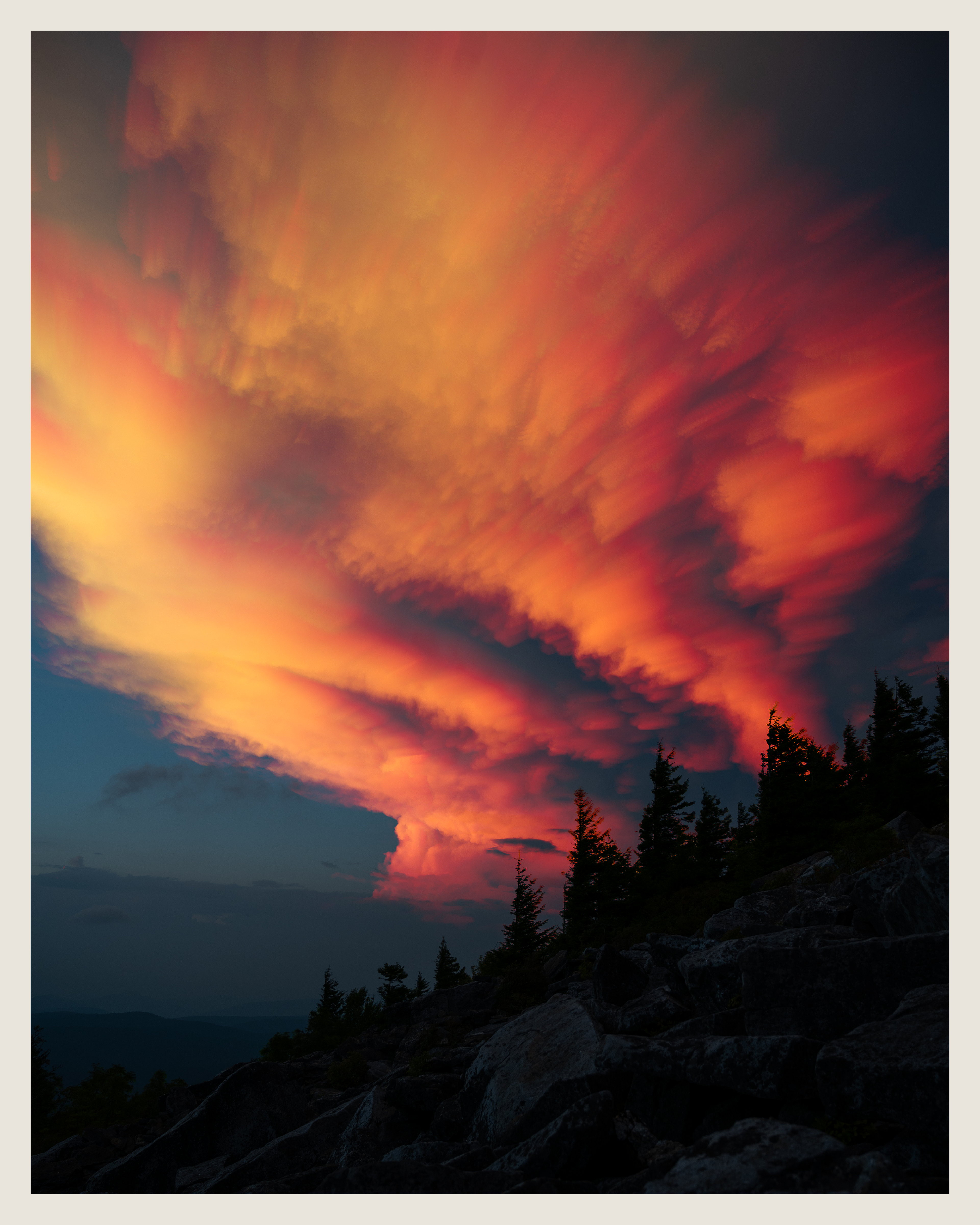
Just as we reached the peak of Spruce Knob, the sun dipped below a cloud on the horizon, and there wasn't much color to be found in that direction. After waiting for a few minutes, these clouds almost directly above us started to light up, so I set up my camera on a 5 second interval timer. My original intention was to do a light blend to capture the movement of the clouds, but the result was a bit underwhelming as the clouds didn't move too much. Instead, I did both a light and dark blend, essentially removing the midtones from the image. That resulted in a much more dramatic scene, and I think better captures the small movement of the clouds. The composition isn't the most compelling, but I tried to capture the wind-stunted red spruce trees that are relatively unique to the area.
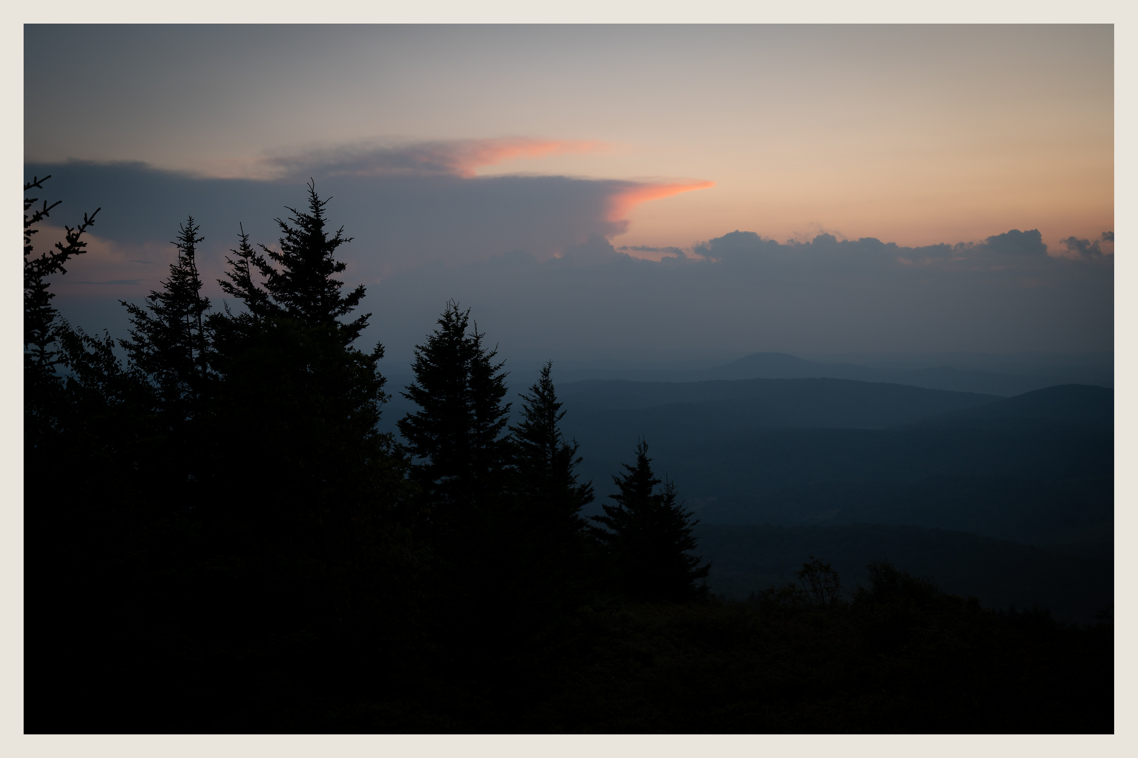
There was some color to be found near the horizon after the sky darkened a bit, but not much.
There was about a 2 hour gap between sunset and moonrise, so we took advantage of this by going to Spruce Knob Lake to see the Milky Way core. It was completely quiet, save for the sound of fish jumping from the water, which was unnerving at first but became less so the longer we were there. The core was visible to the eye for just a few minutes, before being drowned out by the light of the moon. The near-full moon rising in otherwise complete blackness was a sight to behold, as it illuminated the lake and surrounding hills. Unfortunately its visit was also short lived, as it quickly disappeared behind more clouds.

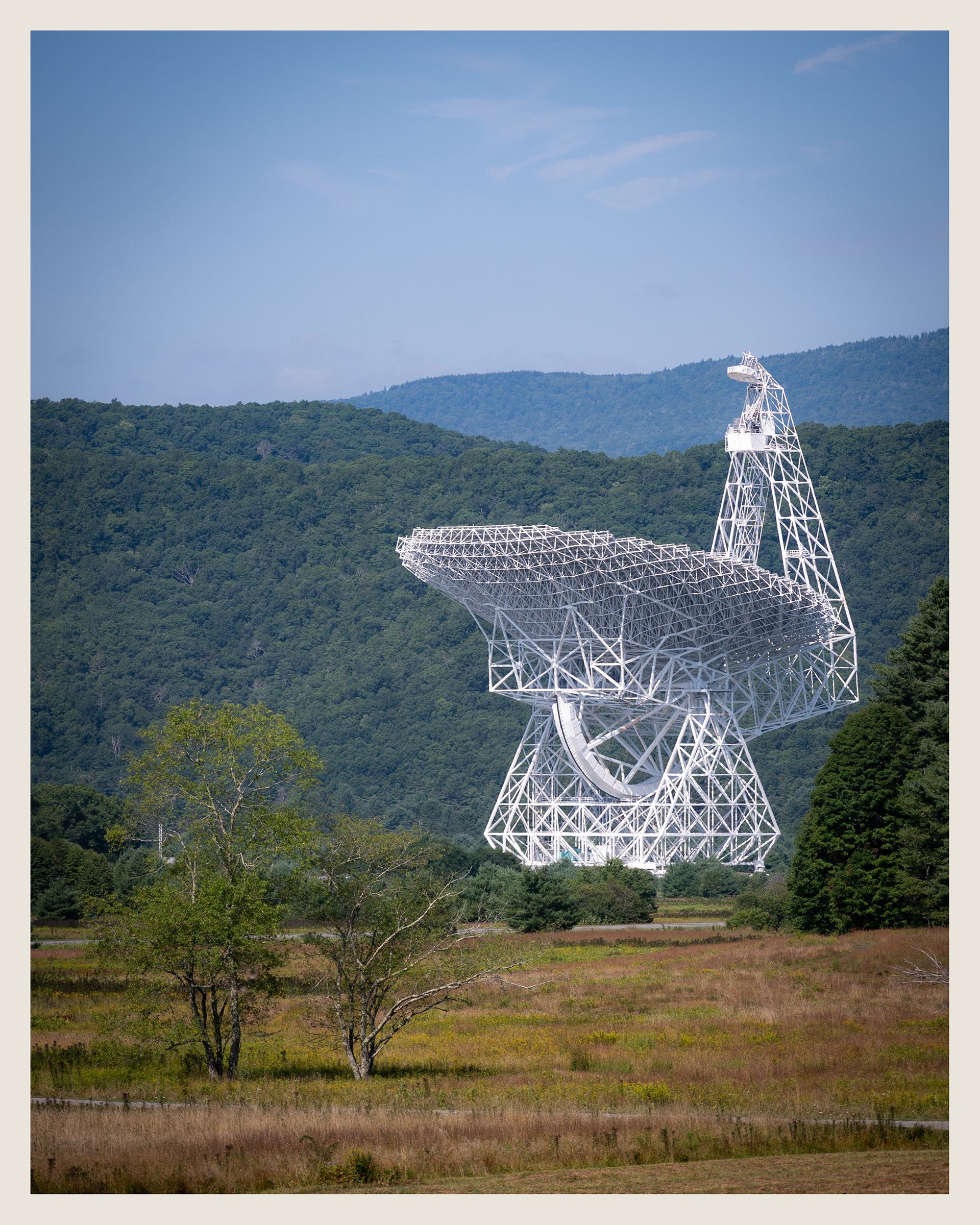
It's incredibly difficult to comprehend the scale of Green Bank Telescope; at almost 500 feet tall and 300 feet in diameter it's a behemoth of a structure. This photo was taken over a mile away from the telescope, and was unfortunately the only angle I captured on my Nikon since electronics aren't permitted on the property.
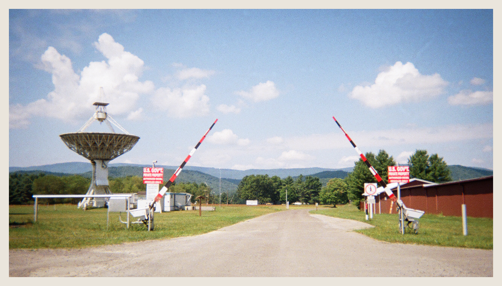
Signage at the entrance to the observatory makes it immediately clear that you're entering a government facility. Also present are signs stating that electronics of any kind are forbidden, and that only diesel vehicles my drive beyond this point.
One of the more visually impressive telescopes on site is the 140 Foot Telescope. It's a polar aligned telescope, meaning its rotational axis is parallel to that of the earth, allowing it to rotate against the earth's spin and easily track objects in the sky. It's the largest in the world of this kind.

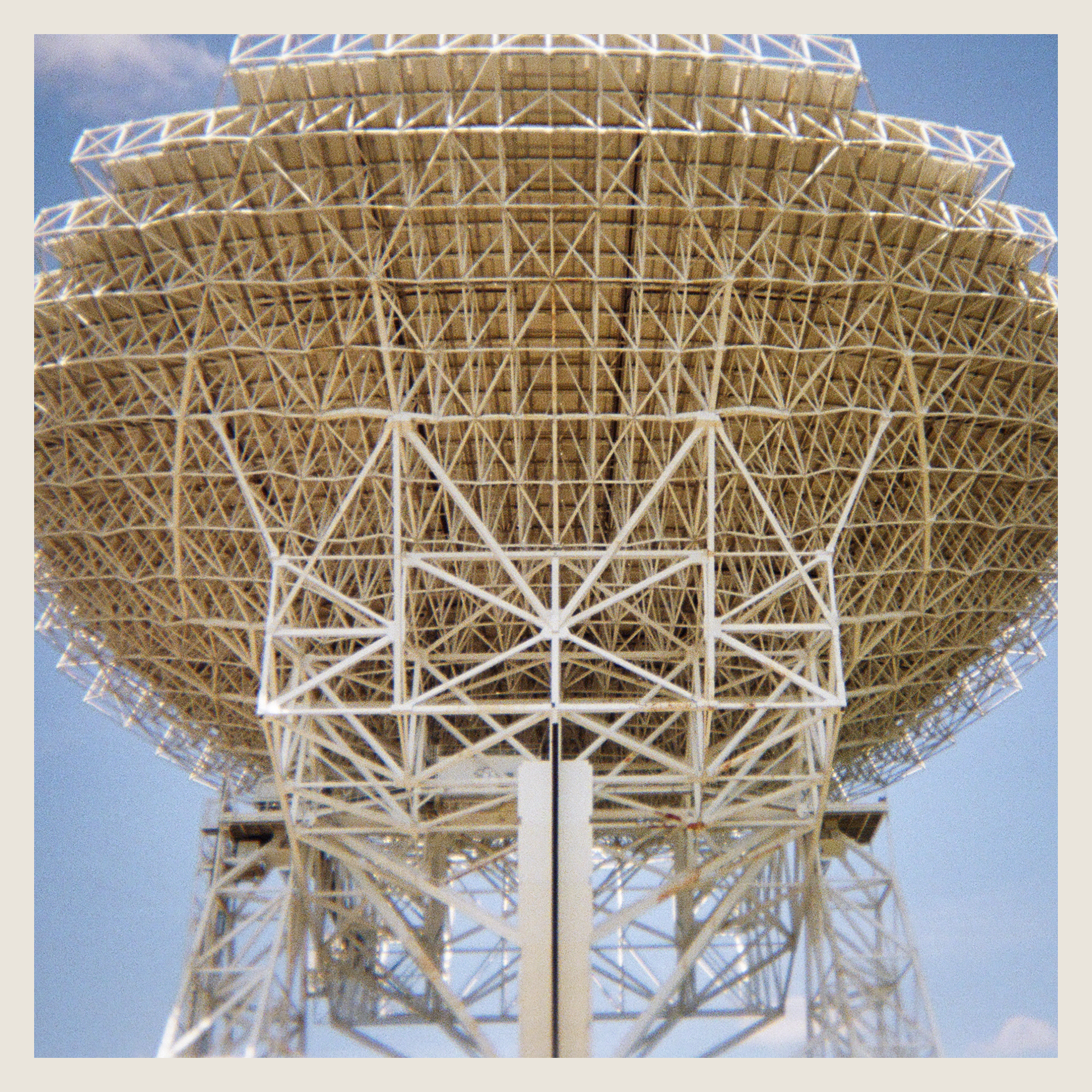
The Green Bank Telescope, the world's largest fully steerable radio telescope, is the star of the observatory. Its scale is difficult to comprehend from photos, but here I'm standing almost directly under the 330 ft diameter dish, which is roughly 250 off the ground. The imposing support support structure is necessary to maintain the dish's precisely smooth surface.
I thought these stalks in the right photo were catching the light interestingly and would make for a good foreground subject. Not a huge fan of how the camera handled the highlights here, as much of the foreground texture is lost and the sky is a bit blown out, but not too much that can be done about it.
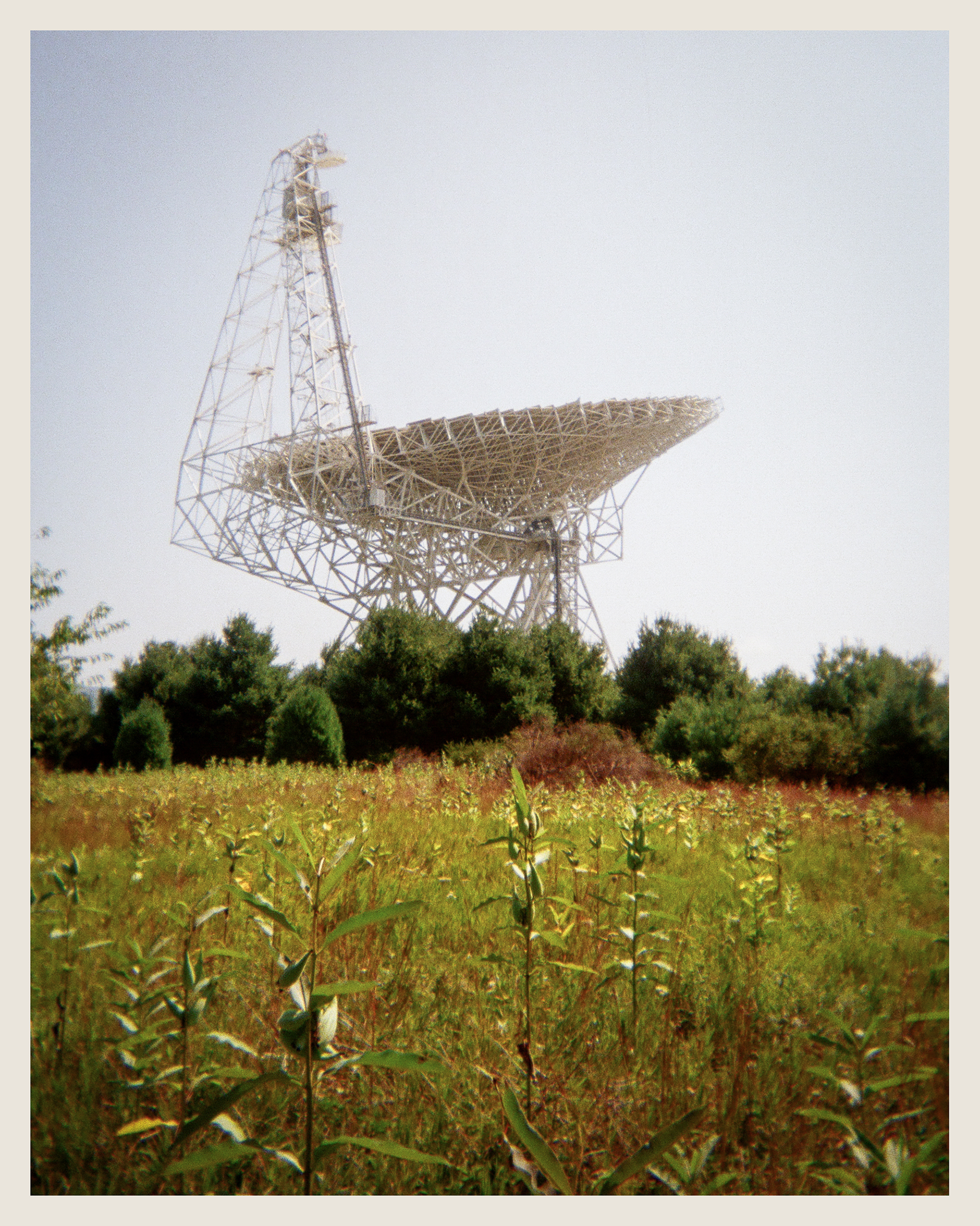
Pictured here is the 85-3 telescope, which works in tandem with the 85-2 and Tatel 85-1 to mimic a telescope about a mile wide. This area of the observatory felt particularly isolated; I imagine many people don't make it this far as it's beyond the GBT.
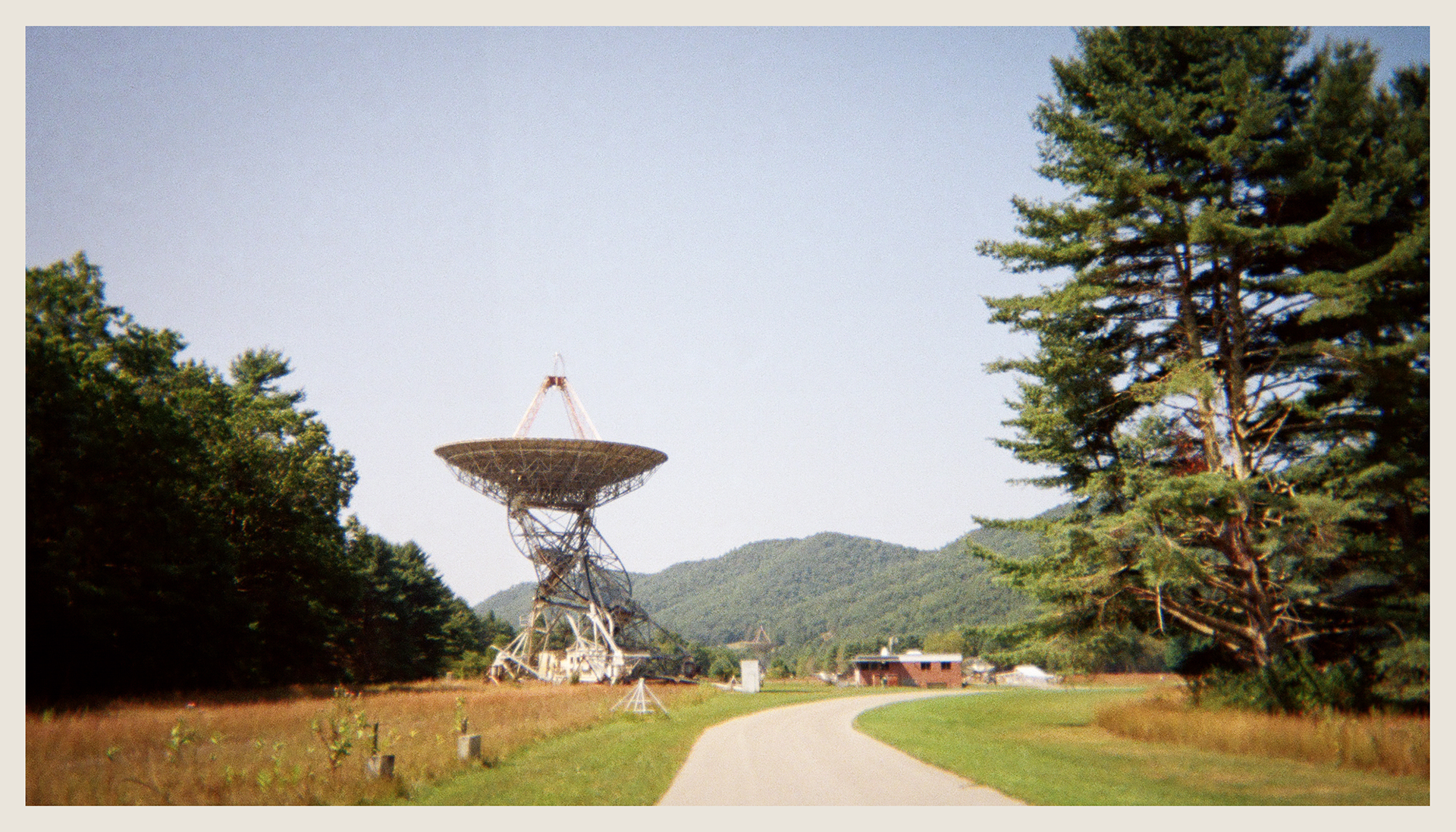
I really like the juxtaposition of these huge highly advanced pieces of equipment situated among what's otherwise rolling hills and mountains of rural West Virginia. You're just driving along through nothingness and suddenly a 500ft structure peeks out behind a hill.

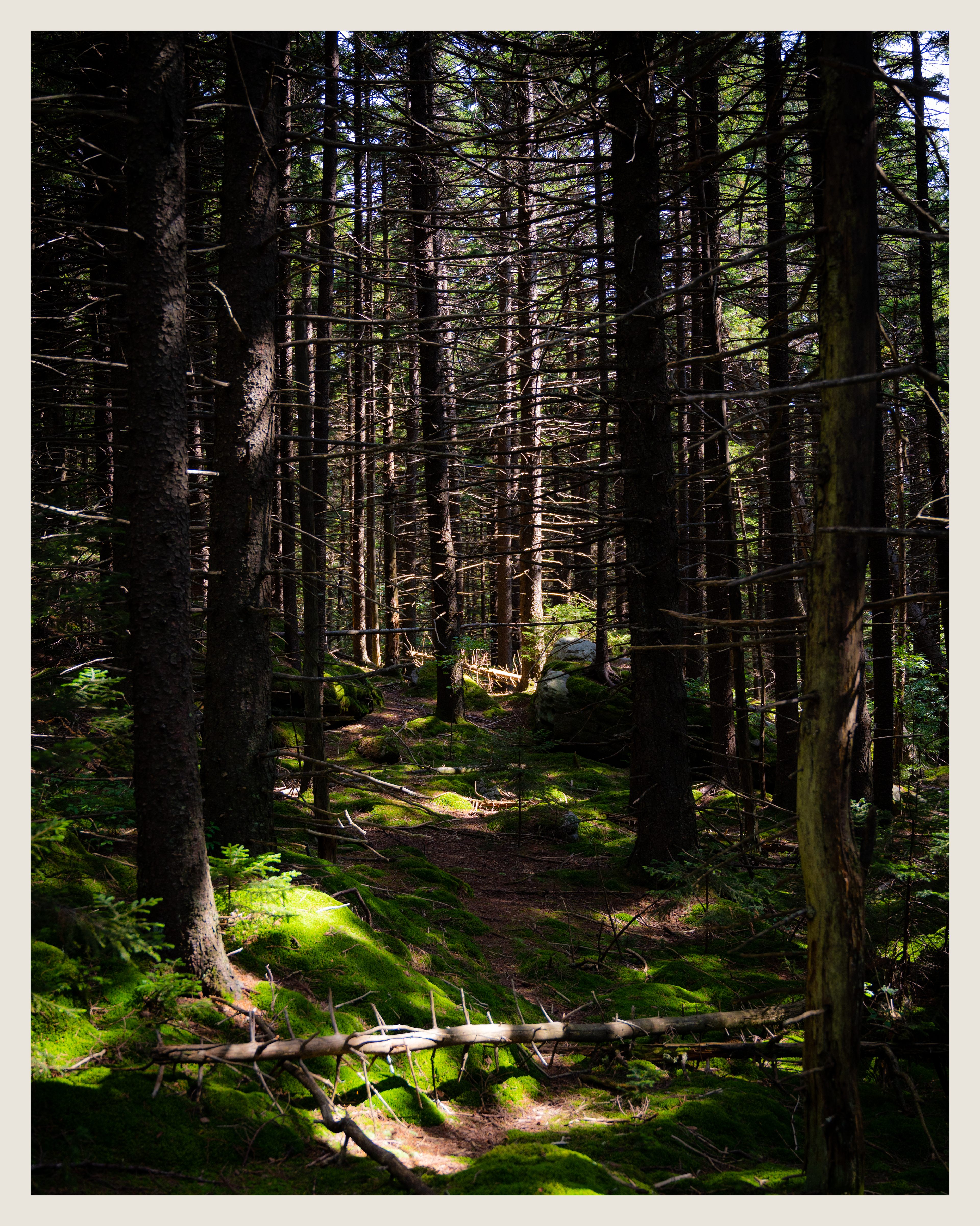
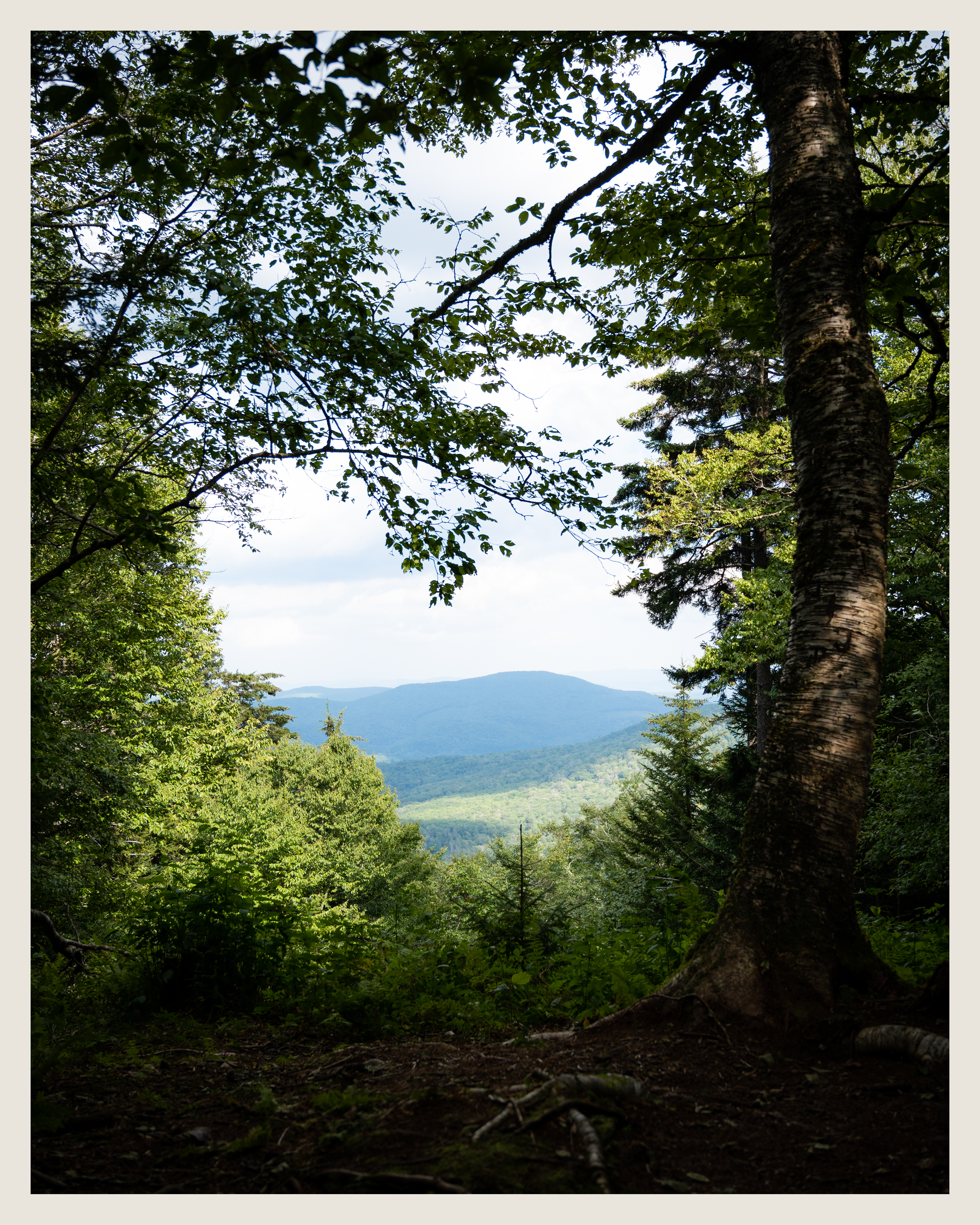
Much of Red Spruce Knob felt more like a meticulously crafted movie set than a natural environment, with its stunning moss covered floor. The shadows contrasted with bright patches of sunlight made shooting even looking photos difficult, but I think the end result almost looks dreamlike. The view from the top was somewhat unspectacular (we actually walked past it and had to turn around), but this hike seemed to be much more about the trail itself than the viewpoint at the top.
I had a couple more hikes tentatively planned, but we opted to head out to make it home at a reasonable hour. We saw a handful of these park signs during the trip, but this one had a nearby pull-off area, so I stopped to grab a couple of photos on our way out.
